Arctus Aerospace is building high-altitude, long-endurance UAVs to offer on-demand, high-resolution geospatial data at a fraction of satellite costs, targeting sectors such as agriculture, infrastructure, mining and security
The startup’s biggest challenges lie in execution, as developing reliable HALE aircraft, securing aviation approvals and delivering on ultra-low operating cost claims will be critical
The vision is ambitious, and Arctus is faced with an uphill task to turn its prototype-stage technology into a viable earth-observation business
An unmanned aerial vehicle (UAV) flying close to the ground and capturing high-resolution images to thrash out a digital map based on data on weather patterns and topography may soon pave the way for precision farming.
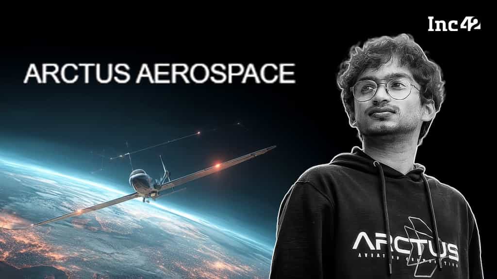
“It can provide a far better result with its ability to cover larger swathes of land from a close range at a fraction of the cost compared to satellites,” claimed Shreepoorna S Rao, founder of dronetech startup Arctus Aerospace, which builds and operates high-altitude, long-endurance (HALE) unmanned aircraft to collect high-resolution geospatial and earth-observation data.
Founded in 2024, Arctus is the brainchild of Rao, an IIT Madras alumnus in his early twenties. Even though in the prototype stage, the startup has fetched an investment of $2.6 Mn from investors across the world.
Rao claims that Arctus’ UAVs would fly much lower than satellites but much higher and longer than conventional drones, allowing them to capture hyperspectral, optical and infrared imagery over large areas on demand and at far lower cost.
Its autonomous aircraft provides precision mapping, surveillance and analytics for sectors such as agriculture, oil and gas, infrastructure, mining, climate monitoring and security. The company also provides geospatial intelligence as a service to customers who need frequent, flexible and high-resolution data without the cost and rigidity of satellite systems.
Currently operating in the global earth observation market, projected to grow to over $8 Bn by 2033, Arctus is taking on a big challenge. Historically, only governments and defence contractors, with deep pockets, have been able to build this kind of platform. So, does the Bengaluru-based startup have what it takes to pull it off?
Rao, who had built his first remote-controlled aircraft in Class VII, gained a full-fledged exposure to the world of spacetech at IIT-Madras, where he also led the aeromodelling club. However, it was Rao’s experiments with complex aviation problems in the final year of his civil engineering in 2024 that nudged him to explore the earth observation space.
He soon realised that geospatial data could only be gathered either by lower-earth-orbit satellites or low-altitude drones. However, satellites are expensive, fly too high for sharp imagery, capture data erratically, and are locked to fixed orbits. Drones are no consolation either, as they have limited range and payload capacity.
Seeing the gap, Rao sat down to build an on-demand solution for delivering high-resolution video over fixed areas at affordable costs. The result — UAVs flying at 45,000 ft, staying airborne for 24 hours, carrying 250 kg of sophisticated sensors. Arctus was born.
His idea soon hit a glass ceiling. Globally, only militaries operate such aircraft, and they’re prohibitively expensive. Existing aircraft cost around $10,000 per hour to operate, and satellites cost hundreds of millions to launch.
To solve this problem, Rao decided to build and operate his own aircraft to collect and sell geospatial intelligence. According to him, Arctus’ UAVs will cost just $100 per hour.
Also, unlike satellite data that can capture 2-3 sq m per pixel from 500 km up, Rao claims that Arctus’ aircraft will be able to capture 1 sq cm per pixel from 10-15 km above Earth’s surface.
“You can see what phone someone is carrying or their shoe brand,” he said, noting that the lower altitude of HALE platforms means sharper output.
“In earth observation, cost per square km is key. Today, a 1-2 sq m resolution image costs $50-60 per sq km. With us, at 1 sq cm resolution, it’s about $1,” he added.
Besides affordability, Arctus is building its competitive edge through vertical integration. Nearly the entire platform – fuel systems, actuators, flight software, and telemetry – is designed in-house, giving the company control over every aspect of performance and economics.
“The only thing we source from vendors is the engine. Building an engine is a whole company, and we don’t want to do that,” said Rao. Only certain specialised components like PCBs are manufactured by R&D partners, but even those are strictly as per Arctus’ specifications.
The company is also not shy about unconventional manufacturing techniques either, using carbon-fibre and metal 3D printing to optimise weight and strength. In Rao’s view, this integration isn’t just about components—it’s strategic. “The assembly and build process is the moat that Arctus enjoys,” he adds.
Then, there is Arctus’ 12-person team that mixes Indian and international talent, mostly engineers from top colleges. But theoretical knowledge isn’t enough. Rao believes that developing HALE aircraft requires craftsmanship. Most team members have hands-on experience building rockets or formula race cars.
As of now, everything that the founder is eying seems ambitious, especially when the company’s UAV is in the prototype stage. The biggest risk going ahead remains execution.
Building a HALE UAV that can fly at 45,000 ft for 24 hours with a heavy sensor payload is extremely complex. This is also because fully autonomous flight, especially over long durations, needs very robust flight control.
Then, Arctus’ geospatial and earth-observation may see too many hiccups. For one, flying UAVs at high altitudes for long durations may not sit well with regulators and commercial flight operators. Moreover, high-resolution imaging can trigger national security and privacy concerns.
Not just this, the company’s value proposition currently hinges on an untested cost advantage — $100 per hour versus $10,000 per hour for comparable systems. The company may not have taken into account maintenance, ground stations, insurance, licences, compliance, training operators, and sensor upkeep.
The founder, as of now, has not shared any details on these visible challenges. Arctus’ idea is bold, but the road ahead is steep for Rao, who will have to navigate everything from engineering execution to regulation, and capital constraints flawlessly for its drones to see the light of day. As rare as this is in aerospace, can Arctus Aerospace disrupt earth observation without satellites.
Editorial Context & Insight
Original analysis & verification
Methodology
This article includes original analysis and synthesis from our editorial team, cross-referenced with primary sources to ensure depth and accuracy.
Primary Source
Inc42 Media