



Key takeaways
- The FireSat program can spot wildfires that other satellites miss.
- FireSat represents the first satellite constellation purpose-built for detecting wildfires, including spotting smaller fires that other satellites may miss.
- The “early adopter” organizations that will start using FireSat data this year include fire agencies in California, Colorado, Australia, and Portugal.
What happened
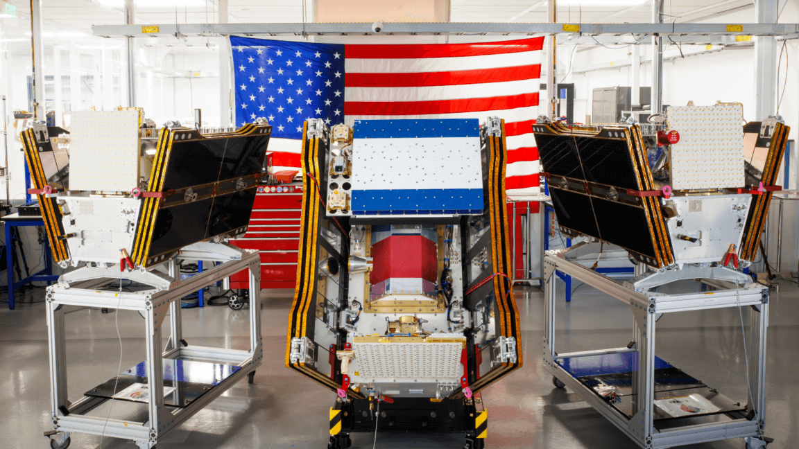
The FireSat program can spot wildfires that other satellites miss. As smoke from hundreds of burning wildfires spread across Canada and the United States, the first three operational satellites in the Google-backed FireSat program successfully launched into orbit. The satellites will begin providing wildfire detection capable of spotting even small fires in the United States, Australia, and Europe before the end of the year.
Detection of small wildfires before they burn out of control could prove extremely helpful. 3 million acres of land. To assist with that capability, Google Research plans to use the company’s AI models to compare operational FireSat data with historical images in order to accurately identify very small fires and to inform predictive modeling of wildfires.
” But Silicon Valley’s rush to deploy newer AI models has also come with considerable climate costs that are linked to a worsening wildfire problem. Larger AI data centers require massive amounts of electricity that are often being met by new natural gas projects in the United States, which could collectively emit more than 129 million tons of greenhouse gases per year.
Why it matters
The launch of the microsatellites aboard a SpaceX Falcon 9 rocket from Vandenberg Space Force Base in California on July 7, 2026 marks a transition to “initial operational capability” for the FireSat constellation managed by the nonprofit Earth Fire Alliance. After a three-month testing period, the three satellites will begin actively providing data to fire agencies while covering every fire-prone region on Earth at least twice per day.
FireSat represents the first satellite constellation purpose-built for detecting wildfires, including spotting smaller fires that other satellites may miss. The satellites were designed by California-based satellite manufacturer Muon Space and have received over $15 million from Google to support initial deployment. Other notable financial supporters include the Bezos Earth Fund that committed $26 million.
Each satellite is equipped with multispectral imaging that can peer through smoke and clouds and detect fires as small as five by five meters—about 16 by 16 feet. That capability was proven by a FireSat Protoflight satellite that launched in March 2025 and collected more than one million images, while showing it could detect low-intensity blazes invisible to existing satellites.
The “early adopter” organizations that will start using FireSat data this year include fire agencies in California, Colorado, Australia, and Portugal. As more satellites launch, the FireSat program aims to provide the latest imagery anywhere in the world on an hourly basis by 2029. Such imagery would eventually become available every 20 minutes once the full constellation of more than 50 satellites is launched by the early 2030s.
What to watch
Google has itself acknowledged the challenges of deploying enough clean energy projects to offset potential emissions from energy-hungry data centers, especially as its company-wide electricity usage grew by 37 percent in 2025. Google’s financial and technical support of AI-powered wildfire detection could prove incredibly helpful.
But wildfire detection is just one of multiple elements necessary to prevent blazes from spiraling out of control—fire agencies also need enough resources to manage ecosystems through prescribed burns and to put out unwanted fires. And their job has become increasingly challenging because of global warming. Traditional fire suppression has proven inadequate in the case of the wildfires that began